
28 August 2026
Threatened remains at Bæjargerði in Jökulsárhlíð
The glacial river Jökulsá has eroded at least 20 metres of the bank where the remains at Bæjargerði lie. In August the site was surveyed and the eroding riverbank recorded.
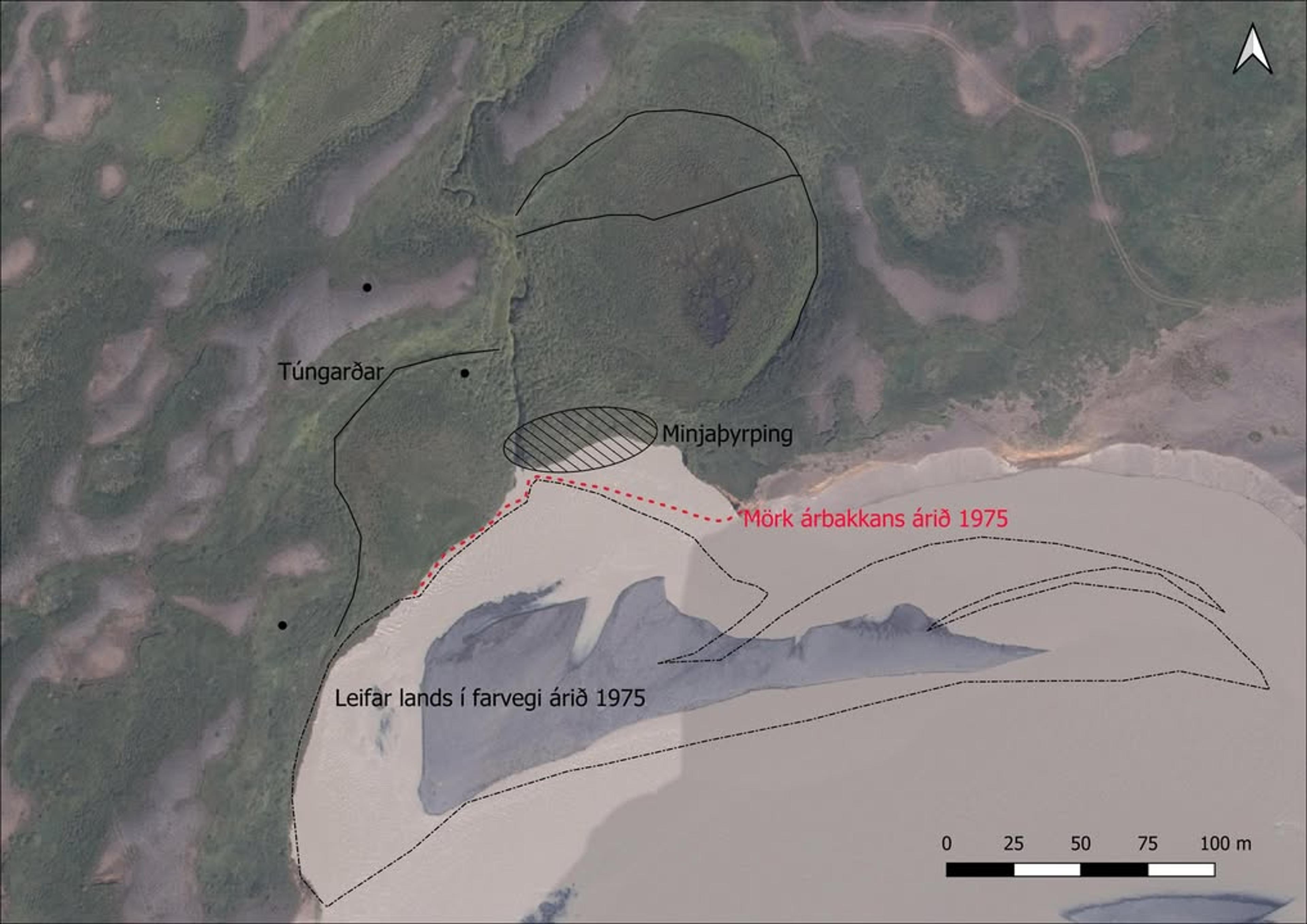
The last site visited in East Iceland at the end of this summer was Bæjargerði, in the land of Sleðbrjótur in Jökulsárhlíð. The farm lay in a hollow, called either Neðstidalur or Bæjargerðisdalur, on the bank of the river Jökulsá. Written sources say almost nothing about it, so the remains are the best evidence of farming at this spot. There are considerable remains in the hollow: extensive home-field walls, an indistinct cluster of remains on the riverbank and isolated features in several places.
The Jökulsá has been aggressive here, and it has clearly already eroded much land in Bæjargerðisdalur. Comparing today’s riverbank with aerial photographs taken about 50 years ago shows that the river has cut away at least 20 m of the bank over that period, exactly where the remains are. The older aerial photographs also show much more extensive traces of probable erosion out in the river (see the markings on the aerial photo), suggesting that there was considerably more flat land in earlier centuries.
During fieldwork this August the remains in the area were surveyed and soil cores were taken. We also tried to examine the eroding riverbank. That is only possible in ideal conditions with little water in the river, so that the sections are visible and work can be done below the bank, and those were exactly the conditions when the site was visited recently. A section about seven metres long was fully cleaned and detailed section drawings were made of the soil, tephra and occupation layers. In addition, a larger part of the bank was inspected where possible, and two more areas were cleaned and photographed.
The section showed a variety of occupation remains, including traces of walls, collapsed turf and other occupation layers. Elsewhere there were thick charcoal layers and lenses of midden material, and in one place a pit full of stones and charcoal was clearly visible. All the occupation layers examined in the section date from the first centuries of settlement; a tephra layer from the Hekla eruption of 1158 was prominent in the section and sealed all the remains investigated there.
The remains at Bæjargerði have clearly suffered considerably, and it is urgent to investigate them further in the coming years before they are damaged further. The team hopes to secure further research funding so that work can continue there in the years ahead.